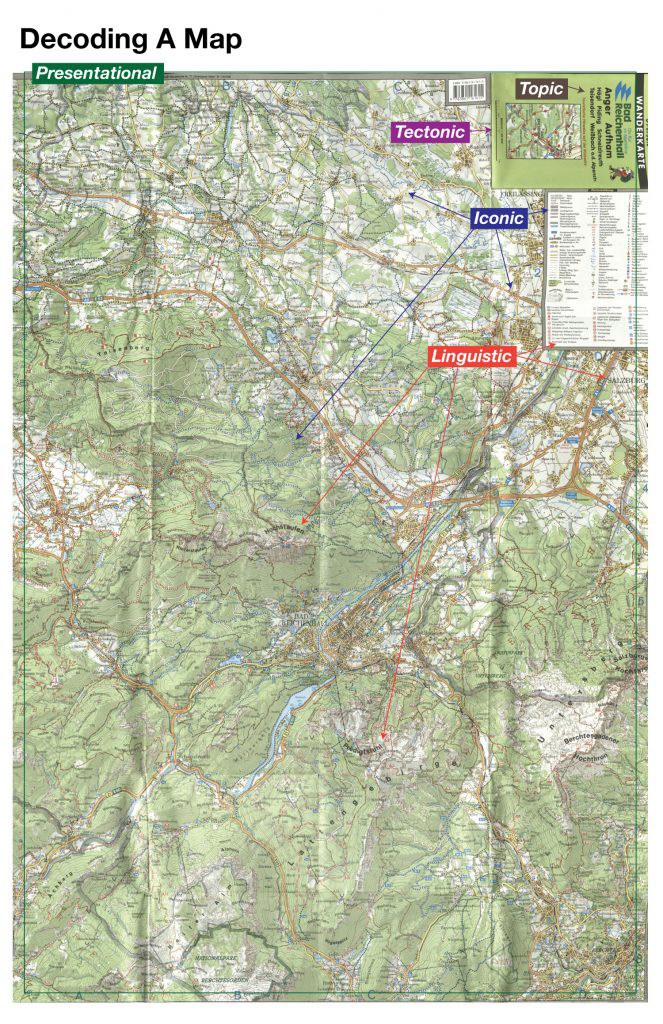
During the first few weeks of this semester, we’ve talked about the map such as Why do people design a map? How do cartographers design a map? How do we analyze a map? For project 1, I’ve assigned a map above to analyze and decode. Thus, in order to decode this map, I’ve used 10 codes that I’ve learned during the past weeks. 10 codes are like below: Iconic, Linguistic, Temporal, Tectonic, Presentational, Thematic, Topic, Historical, Rhetorical, and Utilitarian.
Before begin analyzing the map, I had to know the description of 10 codes for decoding a map. There are two main categories for these 10 codes, one is the intrasignificant, another one is the extrasignificant. The five codes are under the intrasignificant such as iconic, linguistic, temporal, tectonic, and presentation. Other fives are under the extrasignificant such as thematic, topic, historical, rhetorical, and utilitarian. The book, rethinking the power of map <Denis Wood>, we’ve read for this project, explained about theses then codes. Iconic is subsumed the code of “things” with whose relative location the map is enrapt. Linguistic is the code of the names. Temporal code is related to time such as duration or tense. Tectonic is the relationship of things in space is given in the tectonic codes. Concrete instantiations on the map are ordered, arranged, organized by the presentational code. If the presentational code permits the map to achieve a level of discourse, the thematic code establishes its domain. The topic code runs off with the space established by the tectonic code, turns it from space to place, gives the map its subject. The historical code, only it works on the time established in the map by the temporal code. The rhetorical code that sets the tone, that has consumed the presentational code most completely orients the map in its culture, pointing in the very act of pointing somewhere else, to its author. The utilitarian code to be carted off for any purpose myth might serve.
Cover
On the cover, a map designer used a lot of code for creating this map. A person on the top right is used as an iconic code for this map. So when you see this map, even though you don’t know German, you could know that this map is related to hiking. Therefore, a symbol on the top left is a symbol of this area. Linguistic code is used for this map, there is a title of the map, a short description of the map, and some name of the area, those are the linguistic codes. On the bottom, cartographers put the scale, so map users could measure the distance with this scale when they are reading the map. The scale is the tectonic code of this map. Overall, this map is presented well with these codes I’ve mentioned above, so people could take good initial information about this map, that is the presentational code.
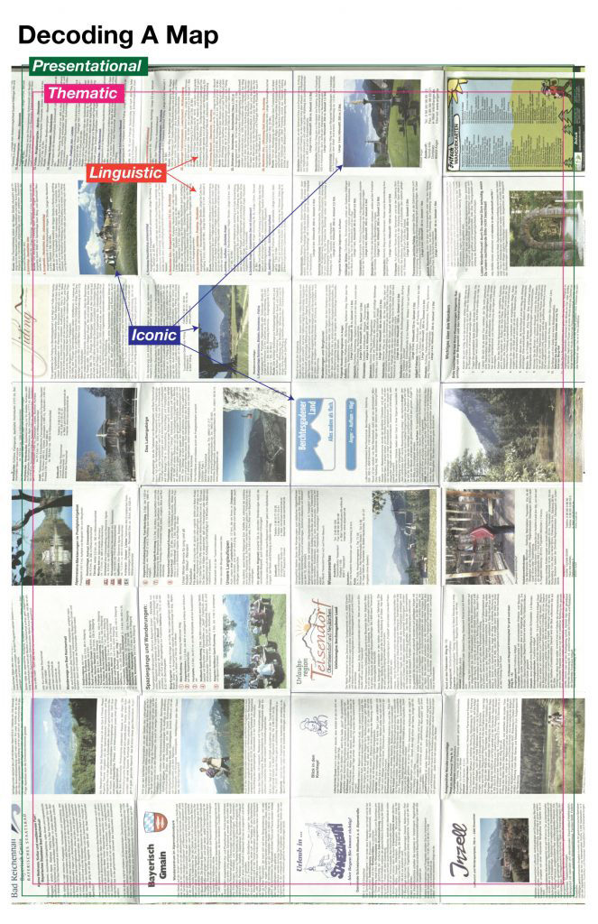
Iconic <Intrasignificant>
This map used symbols and color codes to represent specific information such as roads, facilities, geography, and pathway for hiking at the front page. On the back page, there is a lot of information related to attraction places for people. Images and logos are used as the iconic code for this map.
Linguistic <Intrasignificant>
There is a lot of linguistic codes for the roads, locations, streets, rivers and etc..
Tectonic <Intrasignificant>
This map has a scale on the cover page to help people for
measuring the distance from one to another location.
Additionally, some numbers are on the map, I thought that the numbers could
show the elevation of a specific location on the mountain.
Presentational <Intrasignificant>
I thought that this map is well presented to let people know the information related to this mounting for hiking or other activities.
Topic <Extrasignificant>
On the cover page, there is a title and a short description of this map, it is used as a topic code of this map. Also, the information is on the back page, it could let people know a sub purpose of this map, so it is also used as a topic code.
Reference:
Wood, D., Fels, J., & Krygier, J. (2010). Rethinking the power of maps / Denis Wood ; with John Fels and John Krygier. New York: Guilford Press.